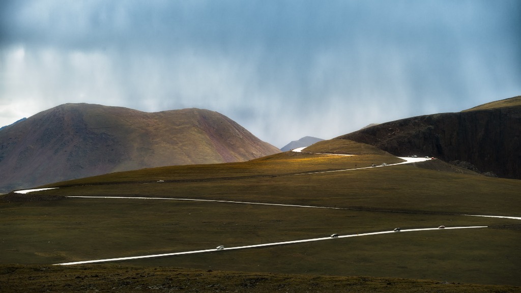
A winding alpine road cutting across golden tundra beneath brooding clouds with a patch of sunlight illuminating the ridge.
How it works

How Sky Sync decides

A sunset is not a weather event. It is light taking a specific path to where you stand. Sky Sync checks that path.

Free forever · No credit card
Trail Ridge Road, Rocky Mountain National Park · Alpine light break

1. The light has to reach you.

How Sky Sync checks the path of the lightSky Sync looks up to 280 miles toward the sun to see whether light can get under the cloud deck, checks 30-meter terrain ridges between you and the horizon, scores Backglow in the opposite sky behind you for cloud burn, alpenglow and the Belt of Venus, and compares the top of the valley fog with the elevation of your overlook.1. Toward the sun · 280 mi (450 km) light pathOpen horizon gapLight slips under deck2. 30m terrain ridge check4. Valley fog ceiling checkYour spot (above fog)3. Behind you · 180° BackglowCloud burn, alpenglow & Belt of VenusSun below horizonSolar azimuth rayOpposite horizon (180°)

Toward the sun

Looks up to 280 miles toward the sun to see whether light can get under the cloud deck.

Over the terrain

Knows the ridges between you and the horizon, so a blocked sun never scores high.

Behind you

Backglow scores the opposite sky, where clouds behind you burn pink alongside alpenglow and the Belt of Venus.

Above the fog

Tells you whether your overlook sits above the fog or in it.

2. Five things make a sunrise or sunset.

Cloud overhead to catch the color. An open horizon toward the sun. Clean air along the way. Nothing low blocking you. Conditions you can shoot in. Wind and rain are shown as a separate badge and do not change the score.

Cloud overhead to catch the color

High and mid cloud overhead is the screen the color lands on. No screen, no burn.

An open horizon toward the sun

Sky Sync looks up to 280 miles toward the sun to check whether low-angle rays can pass under the cloud deck.

Clean air along the way

Smoke, dust and haze each do something different to color. Sky Sync tells them apart along the light path.

Nothing low blocking you

Low fog, stratus or a local mountain ridge in 30-meter terrain data will block the light before it reaches your tripod.

Conditions you can shoot in

Active rain and high wind are surfaced on a separate badge so you know what to expect at the tripod without distorting the sky score.

3. Night is a different problem.

Darkness, cloud, the moon, and for deep sky, steady air.

Milky Way

Scores whether the galactic core rises during astronomical darkness, how many moon-free hours you have, and how scattered moonlight interacts with the satellite-measured darkness of your site.

Aurora

Compares the forecast geomagnetic storm level (Kp) with your geomagnetic latitude and checks cloud cover along your northern horizon.

Deep Sky

Weights upper-air seeing and jet-stream shear alongside atmospheric transparency, scattered moonlight at the zenith, dew risk and wind gusts.

4. Where the data comes from.

NOAA weather models, the ECMWF model, NOAA ensemble and aerosol forecasts, satellite measurements of light at night, and 30-meter terrain data.

NOAA weather models (HRRR 3 km, GFS, NBM, URMA 2.5 km)

High-resolution short-range and global cloud layers, boundary-layer moisture, visibility, wind and precipitation.

ECMWF model (IFS & AIFS)

Medium-range synoptic cloud structure and upper-air wind fields across the full 7-day outlook.

NOAA ensemble and aerosol forecasts (GEFS 31-member & GEFS-Aerosol)

Stratified ensemble members for Floor, Expected and Ceiling score ranges, plus speciated dust, smoke, sulfate and marine aerosol optical depth.

NOAA satellites, radar, stations, tides and space weather (GOES-16/18, NEXRAD, METAR/ASOS, CO-OPS, SWPC)

Post-event infrared cloud verification, live storm radar reflectivity, pre-dawn surface fog visibility checks, harmonic coastal tide curves and planetary Kp aurora forecasts.

Satellite measurements of light at night (VIIRS DNB)

Calibrated zenith sky brightness, Bortle classification and azimuthal urban light-dome profiles.

30-meter terrain data (Copernicus DEM GLO-30 / USGS 3DEP)

360-degree horizon elevation profiles to gate blocked sun paths and model anti-solar mountain alpenglow.

5. What the score is, and is not.

It is physics, not AI: the same inputs always give the same score.

A language model summarizes those calculated factors into a short sunrise or sunset note; it never changes a score.

It is a forecast, not a promise, which is why we show how sure it is and publish how it has held up.

6. How we check ourselves.

We publish our track record, misses included

When we said stay home, we were right 92% of the time. When we said go, the sky delivered 74% of the time. Checked against NOAA observations across 66,000+ sunrise and sunset forecasts in the last 90 days.

7. The technical read.

Kept in full and grouped by topic so you can inspect the exact geometry, atmospheric models and thresholds behind every mode.

Atmospheric Physics & Terrain Geometry

How the physical sub-models work

Up to 280 miles (450 km) light-path ray-casting

For sunrise and sunset, we check whether sunlight can travel under the cloud deck up to 280 miles (450 km) along the horizon, not just whether the sky directly above you is clear. A clear sky overhead means nothing if the distant horizon is sealed.

For the technical read

A fan of rays is projected along the sun's azimuth at the event, sampling low and mid cloud cover at multiple distances (40, 100, 180, 300, 400 and 450 km) toward the horizon, weighted toward the far samples where sunlight enters under the cloud deck. A clearing gradient toward the sun adds a bonus; a sealed near-horizon hard-caps the overall score, because a sealed horizon makes a burn physically impossible no matter how good the sky overhead looks. Directional optical depth is also checked along the sun's corridor.

30m DEM terrain horizon gating

Built on 30-meter elevation data, so a sunrise or sunset that is physically blocked by a local peak or ridge never gets a high score just because the weather forecast is clear.

For the technical read

National terrain-horizon profiles (Copernicus DEM GLO-30 / USGS 3DEP) gate the light-path score at each bearing: if the sun's apparent altitude at event time sits below the local terrain horizon, that path is scored as blocked. Missing terrain data fails open rather than penalizing the score, so the system never guesses at a horizon it cannot see.

180° Backglow: the sky behind you

Backglow checks 180° opposite the sun, sampling clouds at 10, 30 and 60 km for opposite-sky cloud burn alongside mountain relief for alpenglow and the Belt of Venus.

For the technical read

Backglow reuses the horizon-gap and shootability factors from the primary event score rather than recomputing them, since sun-side clearance and wind or precipitation do not change depending on which way the camera is pointed. It adds two checks: cloud cover sampled at 10, 30 and 60 km along the anti-solar bearing, and a terrain-relief lookup against the same 30m DEM terrain-horizon dataset used for the sun-side gate so a mountain range can catch direct alpenglow with no cloud at all. Either source can carry the score on its own; a flat coastal cloud burn and a clear-sky mountain glow are both scored on their own merits, with no bias toward one or the other. If the sun-side horizon is sealed, Backglow caps low regardless because light has to clear the true horizon before it can reach behind you.

Inversion ceiling (ft MSL) and live METAR fog confirmation

Know if you are above or below the fog before you leave home. We compute the cloud inversion ceiling in feet MSL alongside trailhead elevation and post-sunrise burn-off timing, and confirm active fog two hours prior using live <3 km surface station visibility.

For the technical read

Models boundary-layer moisture, 2m dew-point depression, planetary boundary-layer height (HPBL), and 925/850mb thermal inversion caps to badge shallow Radiation Mist and valley Cloud Inversions independently without inflating your sky-color burn score. Within 6 hours of an event (including the T-2h pre-dawn departure check), Sky Sync queries nearby NOAA METAR/ASOS stations to confirm active <3 km surface visibility and compares station elevation against your trailhead to verify when a valley station is socked in below your ridge overlook.

Post-Storm Clearing detection

We detect when a storm system has just broken and cloud cover is clearing rapidly, flagging high-potential Post-Storm Gamble light windows.

For the technical read

Monitors precipitation recency and cloud clearing trends across a multi-hour lookback window, surfacing an active clearing badge for near-term events and applying a score bonus to the light-path horizon gap evaluation.

Speciated aerosol handling and air clarity

Sky Sync distinguishes between five atmospheric haze regimes (smoke, dust, sulfate, marine and clear air), scoring each based on how it affects light transmission and color.

For the technical read

Classifies atmospheric optical depth into distinct environmental aerosol regimes (dust, smoke, sulfate, marine, clear/mixed). Dust and smoke follow independent optical transmission curves, accounting for dust maintaining directional light transmission longer before reaching total opacity, with directional corridor sampling checking air clarity along the sun trajectory.

Physically grounded cloud and moon modeling

We evaluate physical cloud altitude and optical depth, plus scattered moonlight brightness against local VIIRS Bortle sky darkness.

For the technical read

Cloud-screen factor scores base and top altitude directly (distinguishing high ice cirrus from low stratus decks). For night sky modes, a Krisciunas & Schaefer (1991) physical scattered-moonlight brightness model accounts for moon position, altitude and local Bortle sky darkness rather than treating moon phase as a generic percentage.

VIIRS Bortle map, urban light domes and target bearings

See VIIRS sky darkness, directional urban horizon light domes, and the great-circle compass bearing of the sun, anti-solar Backglow or Milky Way core at your saved viewpoint.

For the technical read

Sourced from annual VIIRS radiance composite data with Bortle-scale classification and azimuthal light-dome profiling covering the continental US, Alaska and Hawaii, paired with astronomical event azimuth and altitude bearings so you can plan foreground alignment before opening PhotoPills or TPE.

Aurora Kp geometry and 150 km northern cloud corridor

A high Kp index means nothing if your geomagnetic latitude is too far south or if low clouds block your northern horizon. Sky Sync models geomagnetic latitude (|Λ|) against NOAA SWPC Kp and checks a 15–150 km northern cloud corridor.

For the technical read

Converts geographic coordinates into centered-dipole geomagnetic latitude (|Λ|), computes the Kp threshold required for the auroral oval to clear the local northern horizon (Kp_horizon) or reach an overhead corona (Kp_overhead), and samples a 3-bearing northern azimuth fan (345°, 0°, 015°) at 15, 50, 100 and 150 km to verify low-angle northern horizon clearance.

NOAA coastal tides and seascape window alignment

For coastal spots, Sky Sync pairs the ±90-minute golden hour and night windows with NOAA CO-OPS harmonic tide curves, MLLW water height at event time, and wet-sand reflection or tidepool exposure calls.

For the technical read

Automatically resolves coastal viewpoints within 20 km of the shoreline to the nearest NOAA CO-OPS harmonic station, plotting continuous water-level curves in feet MLLW across the ±90-minute photographic window alongside High/Low tide timestamps, rising/falling stage and receding wet-sand reflection guidance.

4-subject wind stability and 15-minute Calm Lull

6 mph wind is steady for a tripod, but enough to blur a wildflower macro. Sky Sync evaluates wind and gusts across four subjects and pinpoints the calmest 15-minute lull in the window.

For the technical read

Scores 10m sustained wind, gusts and sub-window wind curves against four independent physical stability thresholds: Water & Reflections (glassy mirror vs. chop), Wildflowers & Macro (petal sway and minimum shutter speed), Foliage & Leaves (canopy rustle), and Tripod & Long Exposure (multi-second ND vibration risk), while identifying the lowest-wind 15-minute Calm Lull.

Storm cell vectors and rainbow, mammatus and lightning odds

When convective cells are near your shoot window, Sky Sync tracks cell distance, radar dBZ and echo tops, calculating optical probabilities for solar-antisolar rainbow arcs, mammatus pouches and twilight lightning.

For the technical read

Combines NEXRAD composite reflectivity (dBZ), echo-top heights, storm cell distance and bearing, and solar altitude (< 42° for primary rainbow geometry) to determine whether your tripod stays dry while the anti-solar rain shaft or anvil underside catches direct golden-hour illumination.

Glanceability & Field Workflow

From forecast to field decision

Sky Archetypes and drive-time tiers

Every sunrise and sunset is classified into a specific photographic setup, like High-Canopy Burner or Post-Storm Gamble, paired with a drive-time verdict.

For the technical read

Night-sky events resolve to four shared rating tiers (Excellent, Good, Marginal, Poor) while Sunrise and Sunset cards also classify each event into a photographic Sky Archetype (such as High-Canopy Burner or Post-Storm Clearing Gamble) paired with a drive-time decision tier (Worth 90m+ Drive, Worth 45m Drive, Local <20m, or Skip Drive).

Best-hour callout

We do not just rate the night. We narrow it down to the single best window to be in position, camera ready.

For the technical read

Best-moment evaluation runs at finer time resolution within the scored window, so the callout reflects short-lived peaks in cloud clearing or light quality that a single nightly average would wash out.

Regional quality and topographic fog maps

See which direction has better sunrise or sunset conditions or where valley fog is pooling against 3D mountain contours before you pick a trailhead.

For the technical read

Combines a precomputed regional Sunrise/Sunset quality heatmap with an interactive Topographic Fog & Inversion Map layer that compares boundary-layer inversion ceilings against high-resolution DEM elevation contours, complete with a click-to-inspect point drawer.

Worth the Drive comparison

Compares your saved spots and scans a 50–100 mile radius when better skies sit within driving range.

For the technical read

Runs comparative scoring across up to 10 user-saved locations plus a radial scan. Free users see a notice whenever a nearby viewpoint beats their local forecast; Premium shows the destination, score gain and drive time.

Offline Field Mode for zero-bars trailheads

Save your 7-day outlook and hourly detail forecasts directly to your device before leaving cell coverage.

For the technical read

Persists the complete 7-day forecast payload and hourly timelines on-device across up to 8 saved location and mode combinations with freshness tracking and 1-click pre-departure sync, allowing full day-to-day detail inspection with zero cellular connectivity.

One glance, all four modes

Sunrise/Sunset, Milky Way, Aurora and Deep Sky live in one app with one visual language.

For the technical read

All four modes share the same location model, forecast pipeline and rating vocabulary, with mode-specific factor weighting underneath, so the map, the outlook and the status colors behave consistently no matter what you are shooting.

Audited Against NOAA Satellites

Verification, confidence and explainability

Verified across 100 reference sites on a rolling 90-day basis

We do not grade our own homework. Sky Sync continuously checks its predictions against independent NOAA GOES satellite, URMA surface analyses and live METAR station observations.

For the technical read

Across a rolling 90-day benchmark spanning 100 stratified reference sites, our verification pipeline captures T-2h pre-event boundary-layer visibility and reconstructs post-event conditions from NOAA URMA surface analyses, live METAR/ASOS <3 km surface visibility stations and GOES-16/18 ABI Level 2 satellite retrievals, publishing live confusion matrices and lead-time curves at /transparency.

Ensemble confidence and Floor–Ceiling ranges

Surfaces forecast certainty alongside the Sync Score, showing the Floor, Expected and Ceiling outcome range so you can tell a lock from a gamble.

For the technical read

Evaluates score spread across a stratified sample of NOAA GEFS ensemble forecast members to compute High, Medium or Low confidence tiers plus a Floor–Expected–Ceiling outcome range bar, flagging volatile post-storm setups as High-Reward Gambles and suppressing the badge when ensemble member density is insufficient.

Grounded plain-language reasons

Every rating comes with a clear, plain-English briefing grounded in the physical factor breakdown.

For the technical read

Sync Insights are computed from the physical factor sub-scores, Sky Archetype classification and ensemble Floor–Ceiling bounds. For sunrise and sunset, a language model summarizes those calculated factors into a short note (with a deterministic rule-based fallback); it never changes a score.

Composite score, fully inspectable

Tap into any event to see the weighted physical inputs (horizon gap, cloud screen, 30m terrain gate, aerosol clarity or lunar skyglow) that shaped the call.

For the technical read

The breakdown panel shows each weighted factor individually alongside the multiplicative composite, with explicit data-quality tags (full, partial or degraded) whenever a remote sample is unavailable.

Built to protect the buildup, not automate it away

A photograph is not the half second you press the shutter. It is the hike, the patience and everything that led up to it. Sky Sync handles the forecast so you can keep the craft.

For the technical read

By blending high-resolution short-range models (NOAA HRRR 3km and HRRR-Smoke) with global ensemble models (GFS, ECMWF IFS/AIFS, NBM) across a 7-day horizon, Sky Sync brings weather, terrain and astronomy together while respecting the craft of landscape and night-sky photography.

Check tonight before you commit the drive.

Free forever · No credit card